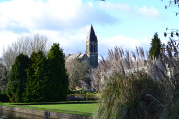
Although Dartmoor may appear to be a wild and untouched landscape, it has actually been subjected to human intervention for over 6000 years. You will find traces of occupation all over the moor, and the area contains the highest concentration of Bronze Age remains in Britain. Features include standing stones, stone rows, hut circles and burial chambers. While many are in remote locations on the High Moor, some are more readily accessible and offer a glimpse into a fascinating aspect of the moor’s history. If archaeology is your thing, here are a few places you might want to visit during your stay:
Grimspound
(OS Map SX701807)
The remains of this Bronze Age settlement date back around 3000 years and form one of Dartmoor’s best-known archaeological sites. The extensive site is made up of 24 roundhouses enclosed within a three-metre-thick stone wall, which is notable for its sheer size compared to other settlements from the time. Excavations at the site revealed paved floors, porches, hearths, raised benches and cooking areas, as well as charcoal, pottery and flint tools. Fresh water for the occupants was provided by the stream running through the northern part of the enclosure. The houses were probably roofed with local turf or thatch and were not much higher than the existing walls suggest today. The remains of medieval ploughing are also evident on the flanks of Challacombe Down, looking west from the site.
Merrivale complex
(OS Map SX554748)
This Bronze Age site is dominated by two long double rows of standing stones, the southern one of which is intersected by a cairn circle. Although clearly of some significance, the exact function of the stone rows and the cairn is unknown and it is also unclear whether the two features were built at the same, or different, times. As the site also contains the remains of a stone circle, a cist grave and several burial cairns, it seems likely that it developed over time, with the different features being added gradually. The site was probably originally much bigger than the remains we see today, as 19th-century maps suggest that two large cairns and a ring cairn have been lost. Although not considered to be part of the main site at Merrivale, there are also numerous roundhouses near the road.
Spinster’s Rock
(OS Map SX701907)
This enigmatic monument is the best-surviving example in Devon of a Neolithic burial chamber, known as a dolmen or cromlech, and was erected around 3500–2500BC. The chamber probably contained several bodies and would have originally been covered by a long mound of earth or stones, which would have served as a ramp to get the capstone, which has an estimated weight of around 16 tonnes, into place. The name of this feature derives from a local folktale that it was built by three spinsters, or spinners, before breakfast, in an effort to shame the weak and lazy men of the village, who couldn’t be bothered to carry out the work themselves. An early example of girl power, perhaps?!
Hound Tor deserted village
(OS Map SX742789)
During the 13th century, Dartmoor experienced a period of population expansion, during which numerous mediaeval farmsteads were established, including the one at Hound Tor. This settlement consisted of four main dwellings, plus numerous ancillary buildings. The dwellings took the form of Devon longhouses, in which the family lived at one end and animals were kept at the other. One of the houses appears to have been of a higher status than the others and contained the equivalent of a granny annexe, as well as an internal area where the family’s more valuable possessions would have been kept. The area of the settlement had probably been farmed since the Bronze Age, but pollen evidence indicates that agricultural activity here had stopped by 1350. Analysis of pottery found at the site suggests that the buildings were occupied for another century until the village was finally abandoned in the 15th century, probably due to a combination of climate deterioration and the Black Death. The tor itself is thought to have been the inspiration for Sir Arthur Conan Doyle’s book, The Hound of the Baskervilles.
Scorhill
(OS Map SX654873)
Sometimes referred to as the Stonehenge of Dartmoor, the stone circle at Scorhill is comprised of 34 stones, 23 of which are still standing. The tallest of the stones frames the sunset on midsummer’s day (hence the reference to Stonehenge), giving rise to the belief that the monument had astrological significance to previous inhabitants. Whatever their purpose, it is clear that the stones at Scorhill form part of a much larger pattern of ancient settlement in this area. There are at least six hut circles and three cairns in the immediate vicinity, and Scorhill lies in the middle of a ‘sacred crescent’ of stone circles situated in the north-eastern part of Dartmoor.